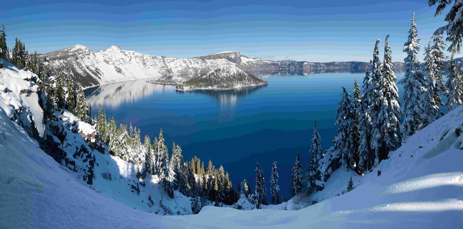
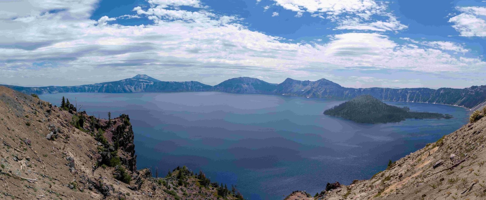
The crater lake eruption of Mount Mazama was a cataclysmic event that occurred approximately 7,700 years ago. This massive eruption, 40 times more powerful than the 1980 Mount St. Helens eruption, reshaped the landscape of the Pacific Northwest. The collapse of Mount Mazama’s summit created a caldera that eventually filled with water, forming the deepest lake in the United States. This article explores the details of this extraordinary geological event and its lasting impact.
What Led to the Eruption of Mount Mazama?

Mount Mazama’s eruption was the culmination of a long volcanic history spanning over 400,000 years. In the 30,000 years leading up to the cataclysmic event, the volcano experienced increasingly explosive eruptions. The final build-up included:
- Preclimactic pyroclastic eruptions
- Lava flows around 8,000 years ago
- Increasing pressure in the magma chamber
These factors set the stage for the massive eruption that would forever change the landscape.
How Did the Eruption of Mount Mazama Unfold?

The eruption of Mount Mazama was a complex event that unfolded in several stages:
- Initial Eruption: The event began with a single vent opening on the northeast side of the volcano.
- Ash Column: A towering column of pumice and ash rose approximately 30 miles (50 km) into the atmosphere.
- Ash Dispersal: Winds carried the ash across much of the Pacific Northwest and parts of southern Canada.
- Pyroclastic Flows: As the summit collapsed, circular cracks opened around the peak, releasing more magma.
- Valley Filling: Pyroclastic flows raced down the slopes, filling nearby valleys with up to 300 feet (100 m) of pumice and ash.
This sequence of events dramatically reshaped the volcano and surrounding landscape.
What Was the Magnitude of the Mount Mazama Eruption?
The eruption of Mount Mazama was truly monumental in scale:
- Power: It was more than 40 times as powerful as the 1980 eruption of Mount St. Helens.
- Scale: It is considered the largest known eruption within the Cascade Volcanic Arc in a million years.
- Ash Dispersal: The ash cloud covered vast areas of the Pacific Northwest and southern Canada.
- Caldera Size: The resulting caldera measures approximately 5 miles (8 km) in diameter and 1 mile (1.6 km) deep.
These statistics underscore the immense power and far-reaching effects of this geological event.
How Did Crater Lake Form After the Eruption?
The formation of Crater Lake was a gradual process following the eruption:
- Caldera Creation: The massive eruption emptied the magma chamber, causing the volcano to collapse and form a caldera.
- Water Accumulation: Over time, the caldera filled with water from precipitation and a hydrothermal system fueled by residual heat from the magma chamber.
- Time Frame: It took approximately 250 years for the lake to reach its current level.
| Characteristic | Measurement |
|---|---|
| Diameter | 5 miles (8 km) |
| Depth | 1,943 feet (594 meters) |
| Formation Time | ~250 years |
The resulting lake is known for its exceptional depth, purity, and clarity due to the lack of organic nutrients.
What Volcanic Activity Occurred After the Main Eruption?
Following the main eruption and caldera formation, volcanic activity continued:
- Wizard Island Formation: Smaller eruptions built Wizard Island within the caldera.
- Merriam Cone: Another underwater volcanic cone formed in the lake.
- Central Platform: Eruptions created a raised area on the lake floor.
- Duration: These post-caldera eruptions continued for about 750 years.
- Cessation: Significant volcanic activity ceased around 4,800 years ago.
While there have been no major eruptions since, hydrothermal activities on the lake floor suggest potential for future volcanic events.
How Has the Eruption Impacted the Surrounding Ecosystem?
The eruption of Mount Mazama had profound and lasting effects on the surrounding ecosystem:
- Landscape Transformation: The eruption dramatically altered the topography, creating new habitats.
- Soil Composition: Volcanic ash enriched the soil, affecting plant growth and distribution.
- Water Resources: The formation of Crater Lake created a unique aquatic ecosystem.
- Biodiversity: The altered landscape led to the development of diverse microclimates and habitats.
These changes have shaped the flora and fauna of the region for thousands of years.
What Can Visitors Experience at Crater Lake Today?
Today, Crater Lake National Park offers visitors a range of experiences:
- Scenic Views: The Rim Drive provides numerous viewpoints of the lake and surrounding landscape.
- Hiking Trails: Various trails offer opportunities to explore the area’s geology and ecology.
- Boat Tours: Guided boat tours on the lake provide unique perspectives and insights.
- Ranger Programs: Educational programs cover the area’s geological history and natural features.
- Winter Activities: Snowshoeing and cross-country skiing are popular in the winter months.
Visitors can also enjoy:
- Accessible trails and viewpoints
- Parking areas around the rim
- Guided tours focusing on geological and cultural significance
How Does the Mount Mazama Eruption Compare to Other Volcanic Events?
The Mount Mazama eruption stands out among volcanic events:
| Volcano | Eruption Date | Magnitude (VEI) |
|---|---|---|
| Mount Mazama | ~7,700 years ago | 7 |
| Mount St. Helens | 1980 | 5 |
| Mount Vesuvius | 79 AD | 5 |
| Krakatoa | 1883 | 6 |
The Mount Mazama eruption’s Volcanic Explosivity Index (VEI) of 7 places it among the most powerful known eruptions in geological history.
What Ongoing Research is Being Conducted at Crater Lake?
Scientists continue to study Crater Lake and Mount Mazama:
- Hydrothermal Activity: Monitoring of underwater hydrothermal vents.
- Water Quality: Ongoing analysis of the lake’s exceptional water purity.
- Climate Change Impact: Studies on how climate change affects the lake ecosystem.
- Geological Mapping: Detailed mapping of the caldera and surrounding areas.
- Volcanic Hazard Assessment: Evaluation of potential future volcanic activity.
This research enhances our understanding of the area’s geology and helps in predicting future volcanic events.
The crater lake eruption of Mount Mazama remains a testament to the powerful forces that shape our planet. Its legacy, Crater Lake, continues to inspire awe and scientific inquiry, offering valuable insights into volcanic processes and their long-term impacts on landscapes and ecosystems.

