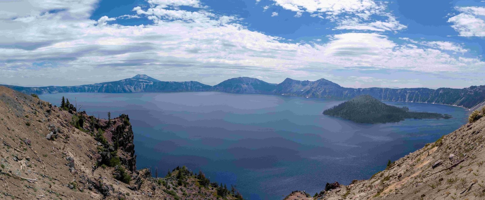
Crater Lake’s cliff height is a testament to the power of volcanic activity and geological processes. The cliffs surrounding this pristine lake form a caldera rim with an average elevation of 2,188 meters (7,178 feet) above sea level. These towering walls, remnants of the ancient Mount Mazama volcano, range from 2,100 to 2,400 meters (7,000 to 8,000 feet) in height. The caldera itself plunges approximately 1,219 meters (4,000 feet) from the rim to its bottom, creating a breathtaking natural wonder that attracts visitors from around the world.
What is the Precise Height of Crater Lake’s Surrounding Cliffs?

The cliffs surrounding Crater Lake form the caldera rim, which has a significant elevation. On average, the height of the caldera rim above sea level is approximately 2,188 meters (7,178 feet). This impressive elevation contributes to the lake’s unique ecosystem and stunning vistas.
How High is the Highest Point on Crater Lake’s Rim?

The highest point on the rim of Crater Lake is Hillman Peak, which stands at an impressive 2,484.4 meters (8,151 feet) above sea level. This peak offers breathtaking views of the lake and surrounding landscape, making it a popular destination for hikers and nature enthusiasts.
What is the Elevation Range of Crater Lake’s Rim?
The caldera rim of Crater Lake showcases a diverse range of elevations, adding to its geological complexity and visual appeal. Here’s a breakdown of the elevation range:
- Lowest point: Approximately 2,100 meters (7,000 feet)
- Highest point: Around 2,400 meters (8,000 feet)
- Average elevation: 2,188 meters (7,178 feet)
This variation in elevation creates a dynamic landscape that offers visitors a variety of perspectives and experiences as they explore the rim.
What are the Notable Geological Features of Crater Lake’s Rim?
The rim of Crater Lake is not just impressive in height; it also boasts several notable geological features that provide insights into its formation and history:
- Volcanic remnants: The rim is composed of the remains of Mount Mazama, an ancient volcano that collapsed to form the caldera.
- Glacial evidence: Signs of past glaciation can be observed along the rim, indicating the area’s complex climatic history.
- Diverse rock formations: The rim showcases a variety of volcanic rocks, each telling a part of the area’s geological story.
- Pumice deposits: Large deposits of pumice, a lightweight volcanic rock, can be found in certain areas of the rim.
- Fumaroles: These vents, which release steam and gases, are evidence of ongoing geothermal activity in the area.
What are the Dimensions and Geological Composition of Crater Lake’s Caldera Walls?
The caldera walls of Crater Lake are a testament to the immense power of volcanic activity. Let’s explore their dimensions and composition:
Dimensions:
- Depth: The caldera is approximately 1,219 meters (4,000 feet) deep from the top of the rim to the bottom.
- Width: At its bottom, the caldera covers nearly a square mile in area, extending from the top of the rim halfway down to sea level.
Geological Composition:
The caldera walls are primarily composed of volcanic rocks that are resistant to dissolution in cold water. This composition plays a crucial role in maintaining the exceptional clarity of Crater Lake. The lack of incoming streams also contributes to the lake’s purity by preventing the introduction of organic materials or chemicals.
| Rock Type | Characteristics | Significance |
|---|---|---|
| Andesite | Fine-grained, intermediate volcanic rock | Forms much of the caldera walls |
| Dacite | Light-colored volcanic rock | Present in some layers of the caldera |
| Basalt | Dark, fine-grained volcanic rock | Found in older layers of the caldera walls |
What Accessibility Challenges Does Crater Lake’s Cliff Height Present?
The impressive height of Crater Lake’s cliffs presents several accessibility challenges for visitors:
- Steep terrain: The rugged landscape makes it difficult for some visitors to explore certain areas of the rim.
- Limited lake access: The Cleetwood Cove Trail, the only safe and legal route to the lake’s shore, is a steep and strenuous 1.1-mile hike that drops 213 meters (700 feet) in elevation.
- Seasonal closures: Many roads and trails are closed during winter months due to heavy snowfall, limiting access to certain viewpoints.
- Altitude considerations: The high elevation can affect some visitors, especially those not accustomed to such altitudes.
What Transport Options are Available for Exploring Crater Lake’s Rim?
Despite the challenges presented by Crater Lake’s cliff height, there are several transport options available for visitors:
- Rim Drive: This 33-mile road circles the lake and is generally open from July to October, offering numerous viewpoints and access to trailheads.
- Shuttle services: During peak season, shuttle services are available to transport visitors to various points along the rim.
- Boat tours: Guided boat tours on the lake provide a unique perspective of the caldera walls from below.
- Hiking trails: A network of hiking trails allows visitors to explore different sections of the rim on foot.
Are There Guided Tours Focused on Crater Lake’s Geological Features?
While there are no specific guided tours solely focused on the geological aspects of Crater Lake’s cliffs, visitors can participate in various park programs and ranger-led activities that include information about the geology of Crater Lake. These programs often cover topics such as:
- The formation of the caldera
- The volcanic history of Mount Mazama
- The unique geological features visible along the rim
- The role of geology in shaping the lake’s ecosystem
Visitors interested in learning more about the geological aspects of Crater Lake can also:
- Attend ranger talks at various locations around the rim
- Visit the park’s visitor centers for exhibits and information
- Participate in seasonal geology walks when available
- Explore self-guided interpretive trails with geological information
By offering these diverse options, Crater Lake National Park ensures that visitors can gain a deeper understanding of the impressive cliff height and geological wonders that make this natural landmark so unique.

