The driving distance from Sacramento to Crater Lake Oregon is approximately 352 miles or 566 kilometers. This journey typically takes between 5 hours and 44 minutes to 6 hours and 1 minute, depending on traffic and road conditions. The route traverses through diverse landscapes, from California’s Central Valley to the Cascade Range in Oregon, offering travelers a scenic adventure through two states.
What is the Exact Driving Distance from Sacramento to Crater Lake?

The precise driving distance from Sacramento, California to Crater Lake National Park in Oregon is 352 miles (566 kilometers). This measurement is based on the most direct and commonly used route, which primarily follows Interstate 5 north before branching off onto state highways as you approach the park.
How Long Does the Drive Take?

The estimated driving time for this journey ranges from 5 hours and 44 minutes to 6 hours and 1 minute. However, it’s important to note that this duration can vary significantly based on several factors:
- Traffic conditions, especially around urban areas
- Road construction or maintenance
- Weather conditions, particularly in mountainous regions
- Number and duration of stops along the way
- Driving speed and style
For a more enjoyable trip, it’s recommended to allow extra time for rest stops, meals, and potential scenic detours.
What is the Best Route from Sacramento to Crater Lake?
The most efficient and popular route from Sacramento to Crater Lake typically follows this path:
- Start in Sacramento, CA
- Take I-5 North through California
- Continue on I-5 into Oregon
- Take OR-140 E towards Klamath Falls
- Follow signs to Crater Lake National Park
This route offers a balance of speed and scenery, taking you through diverse landscapes and several notable cities and towns.
What are the Key Stops Along the Way?
While the drive can be completed in one day, many travelers choose to break up the journey with stops at interesting locations. Here are some recommended stops:
- Redding, CA (162 miles from Sacramento)
- Sundial Bridge
- Turtle Bay Exploration Park
-
Whiskeytown National Recreation Area
-
Mount Shasta, CA (259 miles from Sacramento)
- Mount Shasta (for hiking and scenic views)
- Lake Siskiyou
-
Mount Shasta City Park
-
Klamath Falls, OR (307 miles from Sacramento)
- Upper Klamath Lake
- Moore Park
-
Favell Museum
-
Fort Klamath Museum (337 miles from Sacramento)
- Historical exhibits
- Last stop before Crater Lake National Park
Each of these stops offers unique attractions and can provide a welcome break from driving.
What Should I Know About Road Conditions?
Road conditions can vary significantly along this route, especially considering the diverse terrain you’ll encounter. Here are some key points to keep in mind:
- Interstate 5: Generally well-maintained and easy to drive
- Mountain passes: Can be challenging in winter, with potential for snow and ice
- Rural highways: May have less traffic but also fewer services
It’s crucial to check current road conditions before and during your trip. Resources for up-to-date information include:
- California Department of Transportation (Caltrans)
- Oregon Department of Transportation (ODOT)
- National Park Service website for Crater Lake conditions
What are the Best Seasons for This Drive?
The drive from Sacramento to Crater Lake can be enjoyable year-round, but each season offers a unique experience:
| Season | Pros | Cons |
|---|---|---|
| Spring | Wildflowers, waterfalls at peak flow | Some roads may still be closed due to snow |
| Summer | All park roads open, warm weather | Busiest season, potential for wildfires |
| Fall | Beautiful autumn colors, fewer crowds | Shorter days, cooler temperatures |
| Winter | Snow-covered landscapes, winter activities | Many park roads closed, challenging driving conditions |
Summer is the most popular time to visit Crater Lake, but spring and fall can offer a more serene experience with fewer crowds.
What Should I Pack for the Trip?
Given the length of the drive and the varying environments you’ll pass through, it’s wise to be prepared. Here’s a list of essentials:
- Full tank of gas (and plan for refueling stops)
- Snacks and water
- First aid kit
- Blanket or warm clothing (especially in cooler months)
- Maps or GPS device (cell service can be spotty in rural areas)
- Camera for capturing the scenery
- Sun protection (sunglasses, sunscreen)
- Hiking shoes if you plan to explore at stops
For visits during winter months, additional items like chains for your tires, an ice scraper, and extra warm clothing are recommended.
Are There Any Scenic Detours Worth Taking?
While the direct route offers plenty of beautiful scenery, there are some worthwhile detours for those with extra time:
-
Lassen Volcanic National Park: A slight detour east of Redding, this park offers unique volcanic landscapes.
-
Lava Beds National Monument: Located northeast of Mount Shasta, this area features fascinating lava tube caves.
-
Rogue River-Siskiyou National Forest: A detour into southern Oregon offers beautiful forest scenery and recreational opportunities.
These detours can add significant time to your journey but provide unforgettable experiences for nature enthusiasts.
What Should I Know About Crater Lake National Park?
As your destination, Crater Lake National Park deserves special attention:
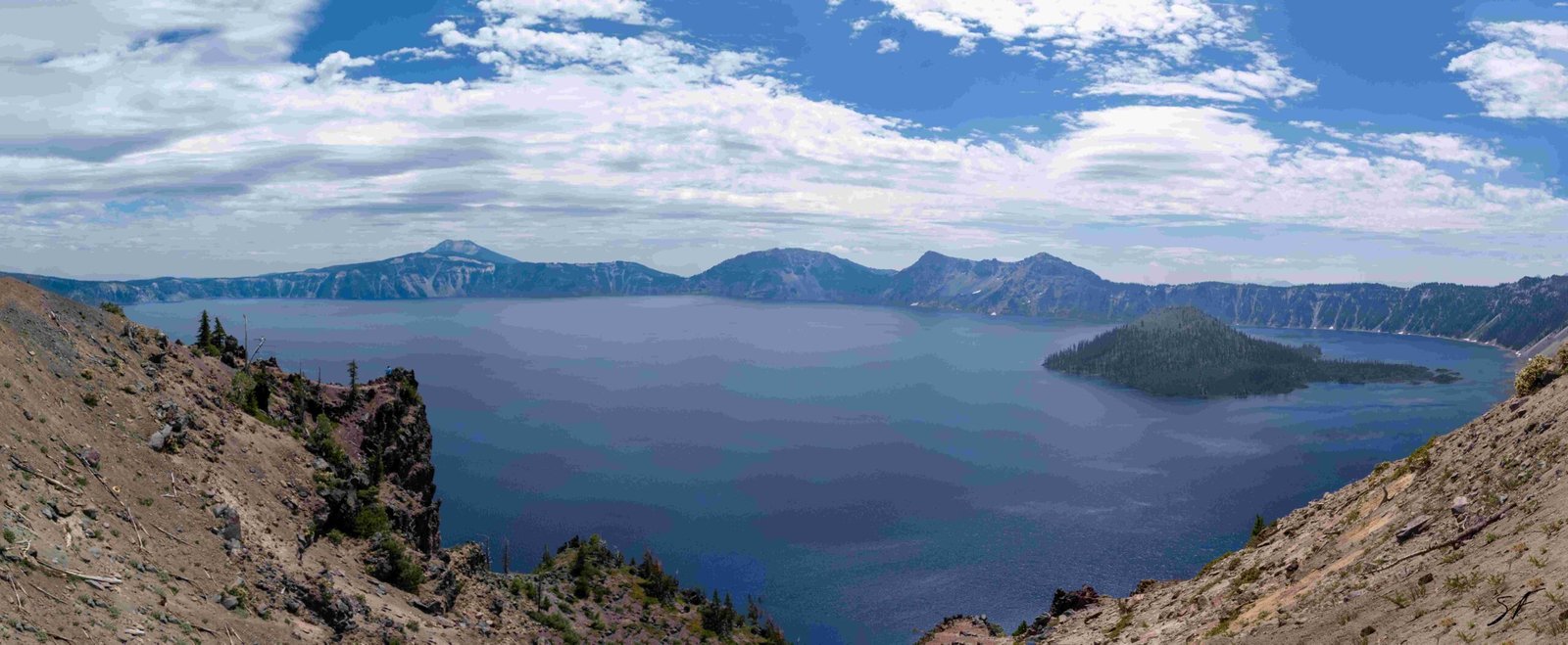
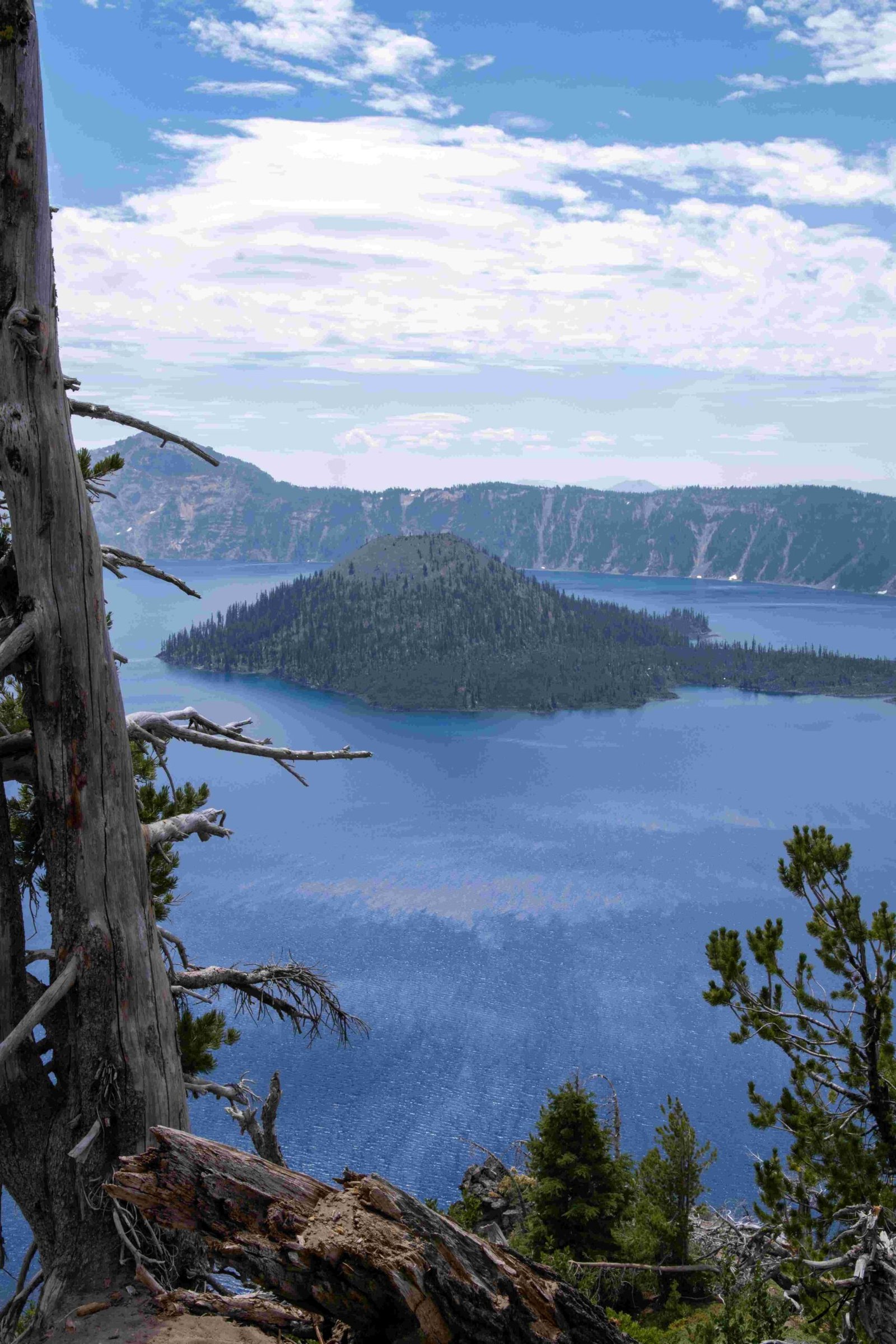
- It’s home to the deepest lake in the United States (1,943 feet)
- The lake is known for its intense blue color and water clarity
- The park offers numerous hiking trails, boat tours, and scenic drives
- Rim Village provides visitor services, including a lodge and restaurant
- Winter activities include cross-country skiing and snowshoeing
Be sure to check the park’s official website for current conditions, as some facilities and roads may be closed seasonally.
How Can I Make the Most of My Drive?
To truly enjoy the journey from Sacramento to Crater Lake:
- Plan your route and potential stops in advance
- Start early to make the most of daylight hours
- Take regular breaks to stay alert and enjoy the scenery
- Consider splitting the drive over two days for a more relaxed pace
- Keep your camera handy for unexpected photo opportunities
- Engage with local communities along the way to enrich your experience
Remember, the journey itself can be as rewarding as the destination. The drive from Sacramento to Crater Lake offers a diverse slice of Northern California and Southern Oregon landscapes, making it an adventure in its own right.
By following this guide, you’ll be well-prepared for your journey from Sacramento to Crater Lake. Whether you’re planning a quick weekend getaway or a longer exploration of the region, this drive offers a perfect blend of efficient travel and scenic beauty. Safe travels on your adventure from California’s capital to one of Oregon’s natural wonders!

