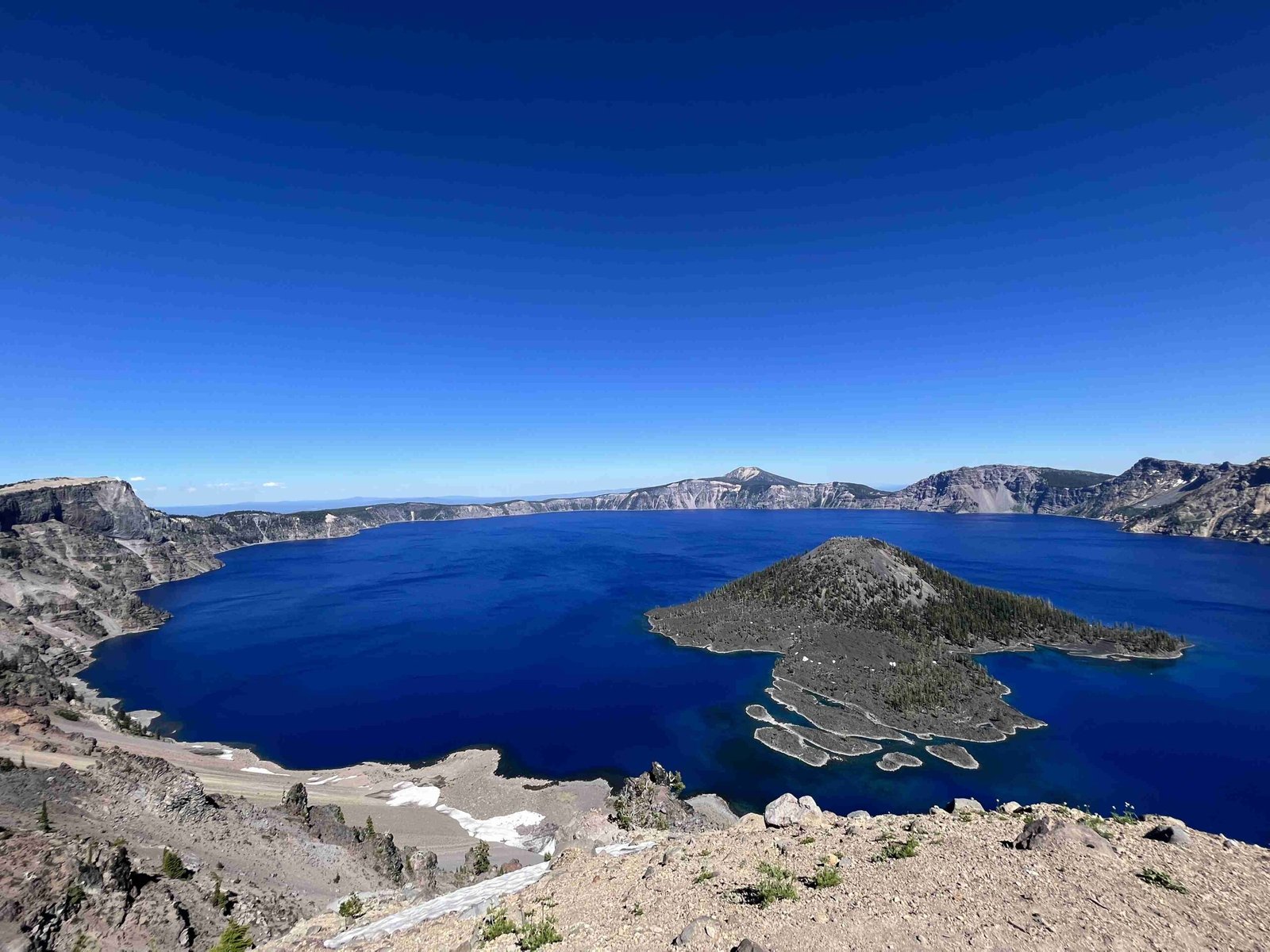
The volcano eruption in US Oregon Crater Lake, also known as the Mount Mazama eruption, occurred approximately 7,700 years ago. This cataclysmic event reshaped the landscape, creating the iconic Crater Lake we see today. The eruption, one of the most significant in the Cascade Volcanic Arc, released about 50 km³ of magma and formed a massive caldera 5 miles in diameter and 1 mile deep. This geological phenomenon has since become a subject of fascination for scientists and tourists alike.
What Caused the Volcano Eruption in US Oregon Crater Lake?

The Mount Mazama eruption was the result of complex geological processes occurring within the Cascade Volcanic Arc. The eruption began with a series of explosive events from a single vent on the northeast side of the volcano. These initial explosions were followed by a climactic eruption that led to the collapse of the volcano’s summit, forming the caldera that would eventually become Crater Lake.
Key factors contributing to the eruption:
- Magma accumulation
- Tectonic pressure
- Gas buildup within the magma chamber
How Did the Eruption Unfold?

The eruption of Mount Mazama was a multi-stage event that dramatically transformed the landscape. Here’s a breakdown of the eruption sequence:
- Initial Explosive Phase: The eruption began with a series of explosive events from a single vent on the northeast side of the volcano.
- Climactic Eruption: This phase released about 50 km³ of mainly rhyodacitic magma, making it the largest explosive eruption in the Cascades in the past 400,000 years.
- Caldera Collapse: The massive eruption led to the collapse of the volcano’s summit, forming a caldera 5 miles (8 km) in diameter and 1 mile (1.6 km) deep.
- Lake Formation: Over the next 250 years, the caldera filled with water from precipitation and snow accumulation, creating Crater Lake.
What Were the Immediate and Long-term Effects of the Eruption?
The volcano eruption in US Oregon Crater Lake had profound immediate and long-term impacts on the surrounding environment and geological landscape.
Immediate Effects:
– Destruction of the surrounding forest
– Massive ash fall covering thousands of square miles
– Formation of pyroclastic flows and lahars
Long-term Effects:
– Creation of Crater Lake
– Alteration of local ecosystems
– Formation of unique geological features within the caldera
| Effect | Timeframe | Description |
|---|---|---|
| Caldera Formation | Immediate | Creation of a 5-mile wide, 1-mile deep crater |
| Ash Deposition | Immediate to Short-term | Widespread ash fall covering vast areas |
| Lake Formation | Long-term (250 years) | Filling of the caldera with water to form Crater Lake |
| Ecosystem Changes | Long-term | Gradual reestablishment and adaptation of flora and fauna |
What Geological Features Resulted from the Eruption?
The volcano eruption in US Oregon Crater Lake created several unique geological features that can be observed today:
- Crater Lake: The most prominent feature, a deep blue lake filling the caldera.
- Wizard Island: A cinder cone that formed during post-caldera eruptions.
- Merriam Cone: An underwater volcanic feature within the lake.
- Central Platform: A submerged volcanic landform in the lake’s center.
- Fumaroles: Areas where volcanic gases still escape from the earth.
These features provide valuable insights into the volcanic history and ongoing geological processes in the area.
Is There a Risk of Future Eruptions at Crater Lake?
While Mount Mazama is currently dormant, it is not considered extinct. The potential for future volcanic activity remains a subject of ongoing scientific study and monitoring.
Factors indicating potential future activity:
– Evidence of hydrothermal activity on the lake floor
– Presence of warm water entering the lake from heated rock beneath
– The volcano’s location within the active Cascade Volcanic Arc
Current risk assessment:
– Mount Mazama is ranked 17th among 161 potentially hazardous volcanoes in the region
– The subterranean magma sources are unlikely to be completely inactive
How is Volcanic Activity Monitored at Crater Lake?
Monitoring volcanic activity at Crater Lake is crucial for public safety and scientific research. Several organizations and methods are involved in this ongoing process:
- U.S. Geological Survey (USGS): Conducts regular seismic monitoring and geological surveys.
- National Park Service: Works in conjunction with USGS to monitor and report any significant changes.
- Seismometers: Installed around the caldera to detect earthquake activity.
- Gas Monitoring: Regular measurements of volcanic gas emissions.
- Ground Deformation Surveys: Use of GPS and satellite data to detect any changes in ground level.
These monitoring systems provide early warning of any potential volcanic activity, allowing for timely response and public safety measures.
What Can Visitors Learn About the Eruption at Crater Lake National Park?
Crater Lake National Park offers numerous opportunities for visitors to learn about the volcano eruption in US Oregon Crater Lake and its geological significance:
- Visitor Centers: Provide exhibits and information about the eruption and formation of Crater Lake.
- Ranger-led Programs: Educational talks and walks focusing on the park’s volcanic history.
- Rim Drive: A 33-mile road circling the lake with numerous viewpoints and interpretive signs.
- Boat Tours: Guided tours on the lake providing up-close views of geological features.
- Wizard Island Tours: When conditions allow, visitors can explore this volcanic cinder cone.
Educational resources available:
– Informational brochures
– Interactive exhibits
– Geological guidebooks
– Junior Ranger programs for children
By visiting Crater Lake National Park, tourists can gain a deeper understanding of the powerful geological forces that shaped this unique landscape and continue to influence it today.

